APPLIED FIELDWORK
Questions
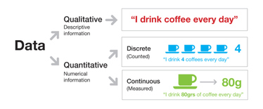
1. Define the terms qualitative and quantitative data - give examples - include diagrams.
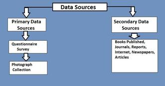
2. Define the terms primary and secondary data collection.
3. Define the terms random data, stratified data and systematic data.
4. Describe how each type of data can be collected.
5. Define the term transect.
6. Describe how your collected your data on the field trip.
1. Qualitative data is data that is a way of collecting data which is describing something, rather than with numbers or statistics. For example, on our Highcliffe trip we collected data about the shape of rocks and this is qualitative data. Quantitative data is a number or statistic, such as the angle of the slope at Highcliffe.
2. Primary data collection is your data and you are collecting it yourself, like when we collected the size of the rocks however secondary data is using someone data that they have already collected, like reading a map, this is secondary because someone has already collected it and you are using it.
3. Random data is when you use a random number generator to find a number and then you use that, for example if the random number generator says 9, you asks the 9th person you see. Stratified is when you choose a certain scale such as every 2m and do it like that, so at 2m 4m 6m 8m ect. Finally, systematic data is a when you have a system for it, such as you measure it every groyne.
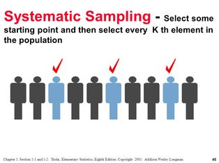
4. Random data may be using a random number generator to get a number and then whatever number that comes up you use that. For example asking the 13th person what they think of how tidy the beach is. Stratified data would be using a system to get data, for example asking 50% men and 50% women Systematic data is a consistent data collection, like every 5 meters.
5. A transect is a line following a route along which a survey or observations are made. We used a transect that went from the sea to the path to collect data.
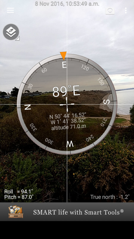
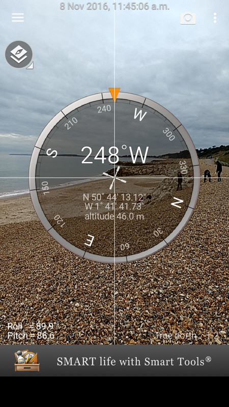
6. We collected the data on our Highcliffe trip in various ways. To start off we put a transect from the sea to the path and put a meter rule every 3m, then we used the gun clinometer to measure the angles from 0-3m, 3-6m, 6-9m ect and we recorded the angle each time. Next we used the quadrant to collect 3 pebbles from each section and then recorded the height, width and depth of them using the caliper,finally collected 10 rocks from each section again using the quadrant and added them to 1000ml of water and we recorded how much the water rose, and recorded how much volume 10 stones had.
5. A transect is a line following a route along which a survey or observations are made. We used a transect that went from the sea to the path to collect data.
6. We collected the data on our Highcliffe trip in various ways. To start off we put a transect from the sea to the path and put a meter rule every 3m, then we used the gun clinometer to measure the angles from 0-3m, 3-6m, 6-9m ect and we recorded the angle each time. Next we used the quadrant to collect 3 pebbles from each section and then recorded the height, width and depth of them using the caliper,finally collected 10 rocks from each section again using the quadrant and added them to 1000ml of water and we recorded how much the water rose, and recorded how much volume 10 stones had.
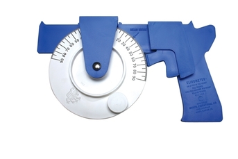
The gun clinometer that is used to measure the angle of the beach slope.
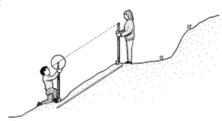
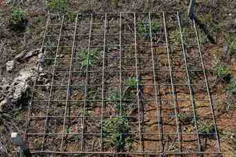
A transect on the beach measuring the angle like we did
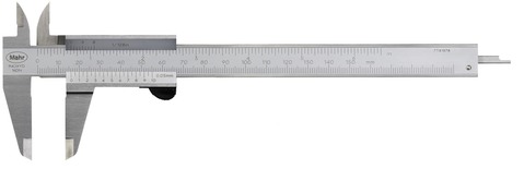
We measure the stones quite accurately using quantitative. We used a quadrat to randomly collect 3 stones, one from the bottom, one from the middle and one from the top of the quadrat (see below). Once we had collected our stones we use the caliper (see below) to accurately measure the height, width and depth of the stone. We only measure the stones in cm so we could've been more reliable and used mm.
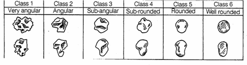
We also measure the shape of the pebbles and this was qualitative data. We had a description card (like below) to decide what category that the stone should go into. We found most were either category 4 or 5 rounded or subrounded.